

Land surveying is an essential component of infrastructure development, including civil engineering projects such as roads, bridges, and buildings. The process of land surveying involves the precise measurement and mapping of a piece of land to determine its boundaries, features, and characteristics. Accurate land surveying is crucial for ensuring that construction projects are planned and executed correctly, and that they are safe and functional for their intended purpose.
The Role of Land Surveying in Infrastructure Development
The role of land surveying in infrastructure development cannot be overstated. Infrastructure projects typically involve large areas of land, and the accuracy of the surveying process is essential for ensuring that the project is designed and constructed correctly. Inaccurate surveying can lead to significant errors in the design and construction process, which can result in safety hazards, environmental damage, and financial losses.
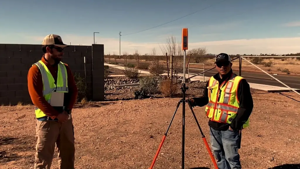
One of the primary functions of land surveying in infrastructure development is to determine the boundaries of the land that is being developed. This is important for ensuring that the project does not encroach on neighboring properties, which can result in legal disputes and financial losses. Surveyors use a variety of techniques and tools to accurately measure and map the boundaries of a property, including GPS technology, theodolites, and total stations.
In addition to determining property boundaries, land surveying is also essential for identifying the topography and physical features of the land. This information is critical for determining the feasibility of a project and for designing the infrastructure in a way that is safe and functional. Surveyors use a range of tools to collect data on the topography and features of a site, including laser scanners, drones, and photogrammetry.
Once the land has been accurately surveyed, the data collected is used to create detailed maps and 3D models of the site. These maps and models are used by engineers and architects to design the infrastructure project and to ensure that it is compliant with regulations and safety standards. Accurate surveying data is essential for ensuring that the infrastructure project is designed to meet the needs of its users and that it is safe and functional for its intended purpose.
The Importance of Accurate Surveying in Infrastructure Development
Accurate surveying is essential for ensuring the success of infrastructure development projects. Inaccurate surveying can lead to significant errors in the design and construction process, which can result in safety hazards, environmental damage, and financial losses. For example, inaccurate surveying can result in the construction of a bridge that is not level or that is too low, which can cause accidents and damage to the bridge itself.
Another example of the importance of accurate surveying is in the construction of high-rise buildings. The surveying process is essential for ensuring that the building is stable and that it is constructed in a way that is safe for its occupants. Accurate surveying data is used to determine the precise location and dimensions of the building, as well as to identify any potential hazards, such as unstable soil or underground utilities.
The Benefits of Technological Advancements in Land Surveying
Technology has played a significant role in advancing land surveying techniques. One of the most significant advancements is the use of Global Positioning System (GPS) technology. GPS technology allows surveyors to obtain highly accurate measurements by using satellites to triangulate their position on the ground. This technology has greatly increased the speed and accuracy of land surveying, making it easier to collect and analyze data.
Like Us on Facebook!
Another technological advancement is the use of unmanned aerial vehicles (UAVs) or drones in land surveying. Drones can capture high-resolution images of a site, which can be used to create detailed maps and 3D models. This technology allows surveyors to collect data quickly and efficiently, reducing the amount of time required for a survey.
Subscribe Us on YouTube!
The use of virtual reality (VR) and augmented reality (AR) in land surveying is also becoming more prevalent. These technologies allow engineers and architects to visualize the design of a project in a virtual environment, allowing them to identify potential issues and make modifications before construction begins. This can save time and money, as it reduces the likelihood of costly mistakes during the construction process.
The Role of Land Surveying in Environmental Planning
Land surveying is not only essential for infrastructure development but also plays a critical role in environmental planning. Environmental planning involves identifying and mitigating potential environmental impacts associated with infrastructure development projects. Accurate land surveying is critical for identifying potential environmental hazards, such as wetlands or endangered species habitats, which can be impacted by infrastructure development.
Surveyors work closely with environmental scientists and engineers to identify potential environmental impacts and to develop mitigation strategies. For example, if a survey reveals the presence of a wetland on a project site, the design of the infrastructure project may need to be modified to avoid impacting the wetland. Alternatively, mitigation measures may need to be put in place, such as the creation of a new wetland to compensate for the one impacted by the project.
The Importance of Land Surveying in Property Transactions
Land surveying also plays a critical role in property transactions. Accurate surveying data is essential for determining the boundaries of a property and for ensuring that the property is accurately described in legal documents. This is important for avoiding legal disputes and financial losses associated with property transactions.
During property transactions, surveyors are often hired to conduct a boundary survey, which involves locating and mapping the boundaries of a property. The survey data is used to create a legal description of the property, which is included in the purchase agreement, for example, for Coburg conveyancing. Accurate surveying data is essential for ensuring that the property transaction is completed without issues and that all parties involved in Coburg conveyancing understand the extent of the property being transferred.
Conclusion
In conclusion, land surveying plays a critical role in infrastructure development, environmental planning, and property transactions. Accurate surveying data is essential for ensuring that infrastructure projects are designed and constructed safely and functionally, that potential environmental impacts are identified and mitigated, and that property transactions are completed without issues. The technological advancements in land surveying, such as GPS, UAVs, and VR/AR, have greatly improved the speed and accuracy of the surveying process, making it easier to collect and analyze data. As infrastructure development continues to play a significant role in shaping our built environment, the role of land surveying will continue to be essential.