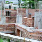
The feasibility of any Civil Engineering Project is determined by the extensive study of an entire area for the identification of feasible route or sites for the construction of project and elimination of others which are impractical or unworkable, an initial survey is being conducted which is known as Reconnaissance Survey.
Purpose of Reconnaissance Survey
- The identification of potential problem and area of keen interest that needs to be study further for the construction of potential site area.
- This preliminary survey is conducted to identify the prospective hazard sites and inform the designer of the project to make the design keeping in view of the potential sites.
- This survey is predominantly used to gather initial information about the presence or absence of historic properties, landscapes etc. within the project area.
- The main objective is to conduct a survey in a specific area about its weather conditions, map and terrain, among others.
- The quantity of earthwork is based upon geology, traffic volume, topography, environment usage along with social &economic land usage.
- The assessment of topography, meteorological data, flood records and various existing communications or services includes this survey.
- The identification and protection of cultural resources will be possible only after the results of reconnaissance survey.
- This survey identify and investigate the archaeological site condition for alignment of route and availability of infrastructure.
Design of Reconnaissance Survey
The design of road corresponds to military characterization and design should be kept in mind in this survey for effective movement during warfare and in future operations.
This survey requires a thorough examination of route plans and if these are not available the following guidelines may be used:
It is convenient to locate the portion of new road along or over existing roads, trials, rail roads as and when required.
It is convenient to locate the road along streamline and ridges, so that minimum drainage structures is provided resulting in saving the cost and time of overall project. In case of streams, it is important to keep the grade well above the high water line.
In order to avoid unnecessary earthwork, it is better to locate the road along contour lines and as practical approach the route selection is such that it is as near to sources of material to save the cost of transportation.
In the case of hills and canyons, place the road so that the slope of the strata tends to support the road rather than dragging it down the canyon.
In case of warfare, place the road in such a manner so that it may be protected and concealed from enemy line of fire. In some cases, technical consideration must be sacrificed.
Site selection should be made in such a way as to retain the technical assets already constructed and to avoid the felling of rock structures and excessive clearing.
Like Us on Facebook!
Also Read: Types of theodolite in Surveying (Advanced)
Subscribe Us on YouTube!
Methods of Reconnaissance Survey:
Survey Sheet and Maps
A thorough review of all available data including survey sheets and maps forms the basis of this investigation. By examining the various features of the topography on the maps, various achievable economic alignments are chosen, keeping in mind the factors below:
- Alignment that considers all control points is shorter and more accessible while meeting slope and curvature requirements.
- The shape of alignment.
- Critically problem solving technique.
- The locations subjected to extreme climatic conditions should be avoided like steep terrains, marshy ground, unstable hill features, flooding and inundation areas as much as feasible.
- The requirement to connect key villages and towns.
- The ecological balance along with conservation of ecosystem are to be kept in priority.
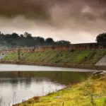
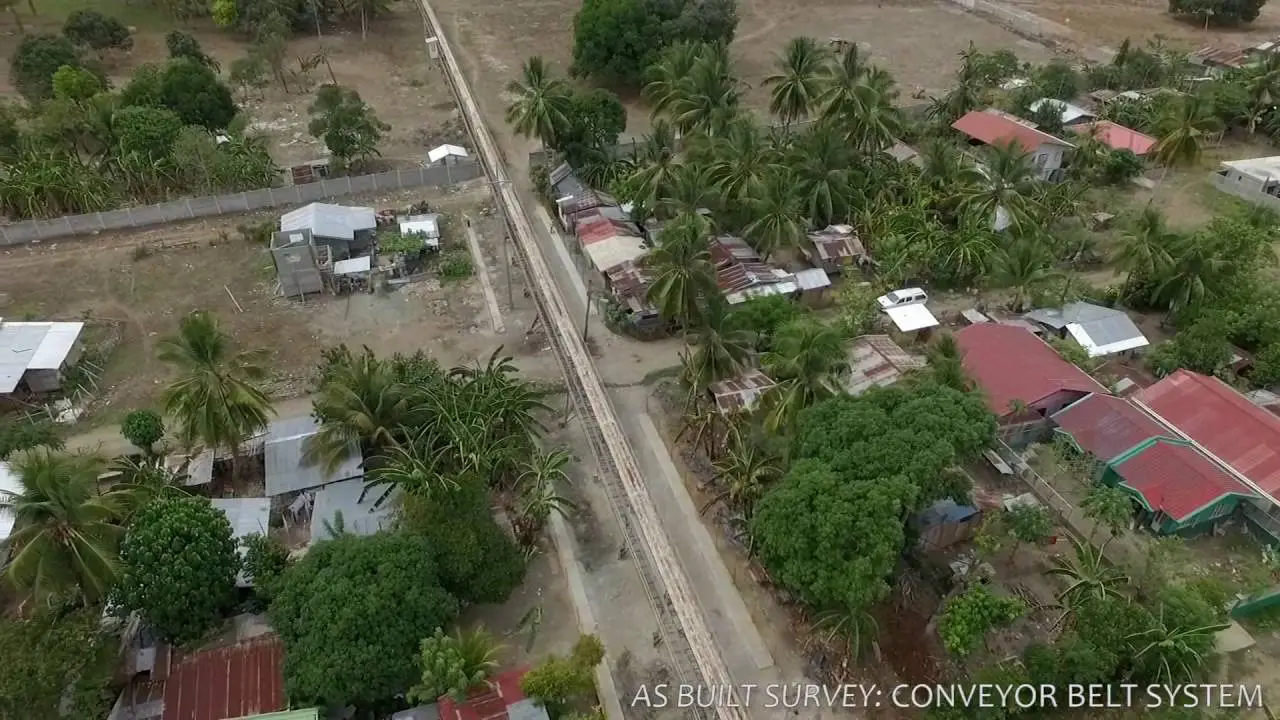
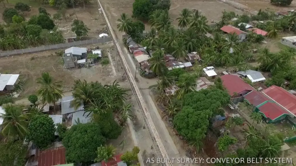
Aerial Reconnaissance Survey
This survey will provide aerial perspective of the alignments under consideration along with the surrounding environment.In order to enhance the information provided by the topographic maps, the aerial images so obtained should be taken at a scale of 1:20000 to 1:50000.Aerial images obtained using stereoscopic techniques give quantitative data as well as subsoil and ground information and the evaluation will be carried out by a professional photo interpreter.This survey will help in identifying which alignment is better to explore in depth of ground.
The modification or rejection of any alignment will be done by the evaluation of this survey.
Also Read: Difference between Prismatic and Surveyor Compass – Types – Uses
Ground Reconnaissance Survey
Ground reconnaissance entails a general investigation of the ground by walking or riding along potential routes and gathering all relevant information for evaluation.
This survey will gather all the relevant information by the investigation of the ground by walking or riding along the potential routes
In the case of hilly sections, it may be appropriate to start the survey from a mandatory position near the top.
To avoid any doubt for ground reconnaissance, an aerial method must be employed.
The most commonly used ground reconnaissance instruments are; pedometer, clinometers, aneroid barometer, Abney level / alti-meter, Compass, ghat tracer and other instruments.
To facilitate future ground surveying operations, it is best to leave the reference pegs during the reconnaissance.
Walkie-talkie sets which are modern source of communication are beneficially in rough and challenging terrain.
The above mentioned tools acts as a check on the map to get the height of crucial stream crossing, maximum gradient, ground slopes and position of mandatory points.
Also Read: The Benefits of Mapping via Ground Probing Radar Surveys
Reconnaissance Survey Reports
A report should be created based on the information gathered during the.
After including the information collected during the reconnaissance survey, a report is generated. This reconnaissance survey report includes all the required information gathered during the survey, as well as a 1:50,000 scale plan showing the alternative alignment studied, taking into account their preliminary cost estimate and their general profile.
This report will also outline the pros and cons of the various possibilities to aid in the selection of various alignments for further research and investigation.
Also read: Qualities For A Good Estimation Engineer Quantity Surveyor
Advantages of Reconnaissance Survey:
- The first and primarily survey completed before any other survey results in expediting the work.
- It is reliable because the team already knows the area during the project, so it is unlikely that they will make a mistake because they may have to navigate their way through unfamiliar areas during a field investigation.
- The additional survey will save money and time because the initial survey has been done and there is no need to re-survey.
- This allows for a better understanding of the project area by having predetermined guidelines, thus minimizing work-related error.
- It confirms results are precise and reliable due to various factors such as;
- The maps have been updated.
- Information from topographic maps and aerial photographs has been used.
- The terrain can be surveyed more than once due to the fact that more information regarding the area has been obtained hence ensuring reliability.
Disadvantages of Reconnaissance Survey:
- There is limitation of the time frame resulting in works may not be completed in due course of time.
- The area may be larger than expected and therefore more time may be required to complete all aspects of the project resulting in higher costs.
- The effectiveness of this survey is less because the area has already been surveyed and it cannot be used for future survey hence requiring that new areas must be surveyed and recorded.